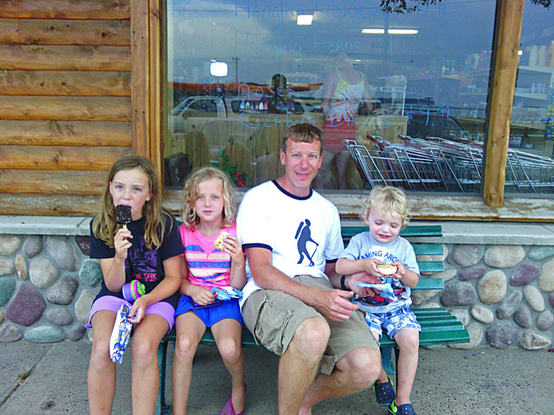
We arrived at Woodland Park Campground in Grand Marais around noon and made a couple loops around the campground to find a site. All of the sites here are fist come fist serve so we like to try to arrive here early in the week. On this Sunday morning about a third of the sites were opening up. We were all excited to be back in one of our favorite campgrounds after not making it here last year.
Trip Highlights - Click to jump to that section
Camping at Woodland Park in Grand Marais, MI
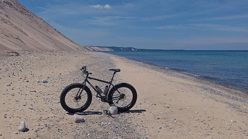
Fat Biking along the Grand Sable Dunes
Kayaking from Miners Beach to Mosquito Beach
Fat Biking 12 Mile Beach
|
| Camping at Woodland Park in Grand Marais: |
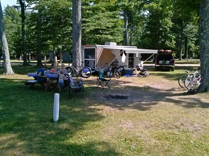 |
| All of the sites with a Lake Superior view were taken so we settled into site 97 on the east side of the campground. |
|
 |
| We have stayed in the sites in this area before and we like that they back up to a big grassy area which I think is probably the drain field for the nearby bathhouse that you can see in the background above. Because of this the sites are also a little deeper than the others that back up to each other.
All of the sites at Woodland Park have electric, water and even cable TV hookups. There is also Wifi internet , but like most campgrounds the service was inconsistent. Also remember to take quarters for the coin operated showers and laundry.
More Woodland Park information and a campground map >>
|
|
| Fat Biking along the Grand Sable Dunes: |
 |
| After setting up camp we went down to the beach for the afternoon.
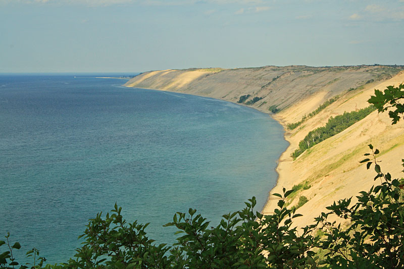
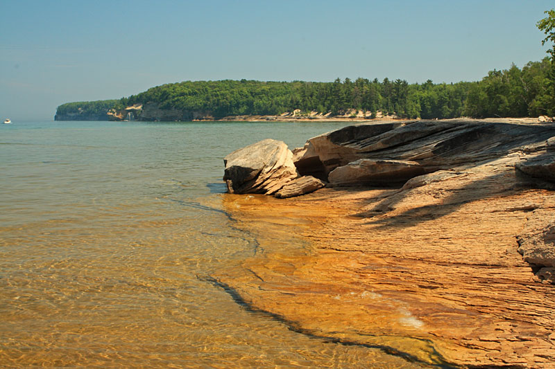
I brought down the fat bike and headed off towards the Grand Sable Dunes. The first couple miles up past Sable Creek were loose and rocky making for a ride that was both hard on the rider and the equipment. After that it smoothed out for some nice beach cruising. This ride gives you an up close view of the Grand Sable dunes that few get to see and is one of my favorite beach rides I have taken. |
|
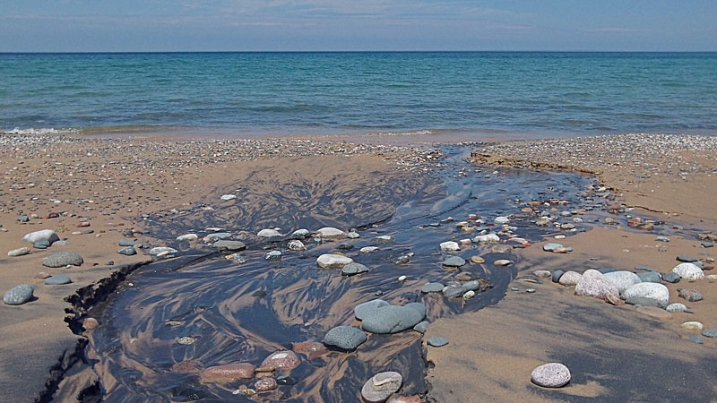 |
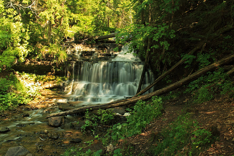
| In addition to Sable Creek there are several smaller streams flowing out from the base of the dunes into Lake Superior. |
|
|
GoPro time-lapse of the fat bike beach ride along the Grand Sable Dunes.
The ride on the beach from Woodland Park campground to just past the Log Slide Overlook was about a 12 mile round trip that took about 1.5 hours to complete. |
|
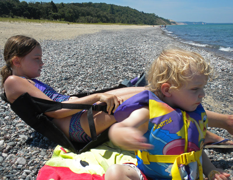 |
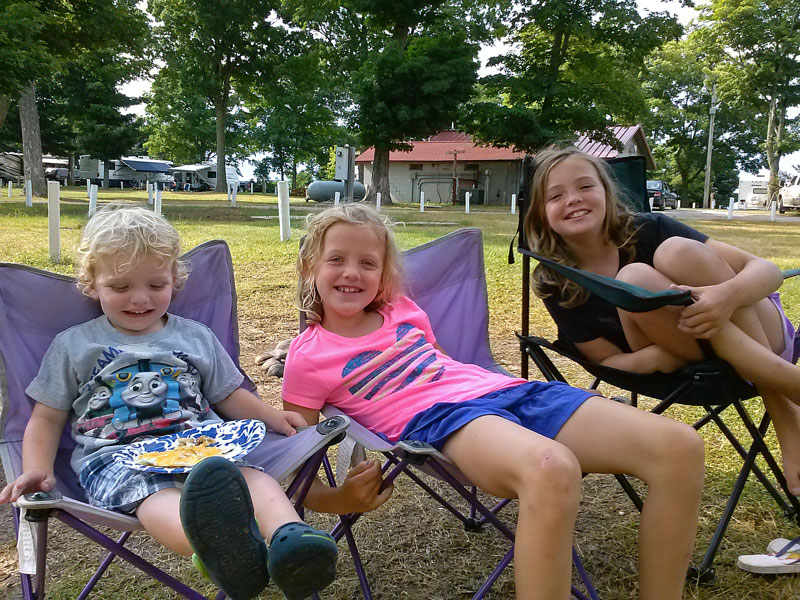
| When I got back everyone was looking tired so we relaxed and took in the view for a little while and then it was back to swimming and throwing rocks. |
|
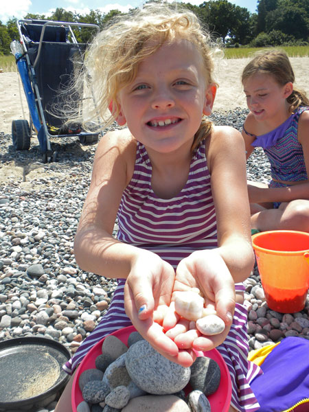 |
| The best part about the beach in Grand Marais is collecting rocks. |
|
|
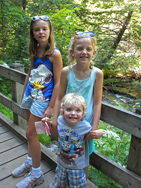
| Regan showing us the rocks and the fish in Lake Superior. |
|
 |
| After dinner we drove to see the log slide overlook. When we were just a little ways down the trail we were attacked by the flies and mosquitos. It was bad enough that everyone decided to turn around and run back to the car. I continued to the overlook and tried to get a photo, but it was hard to hold the camera still while my legs constantly getting eaten. |
|
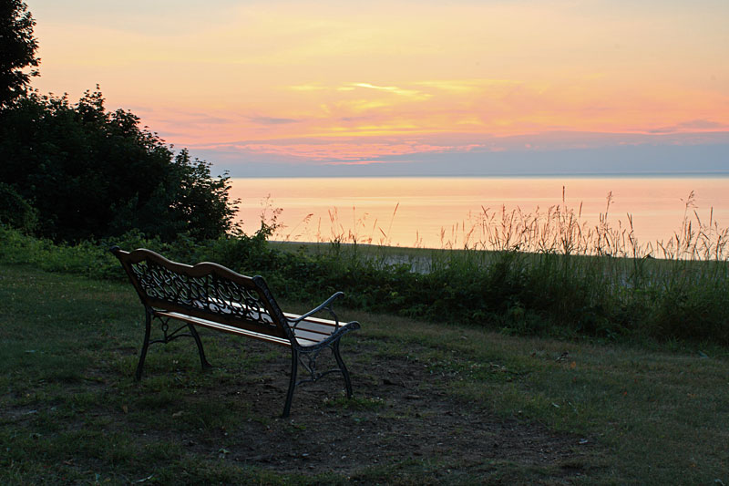 |
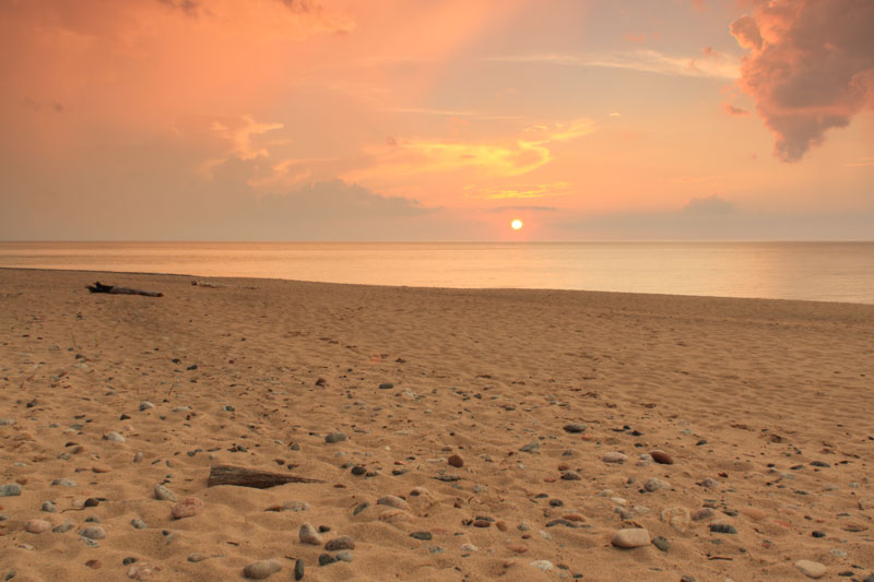
Sunset from up by the campground.
|
|
| Kayaking from Miners Beach to Mosquito Beach: |
 |
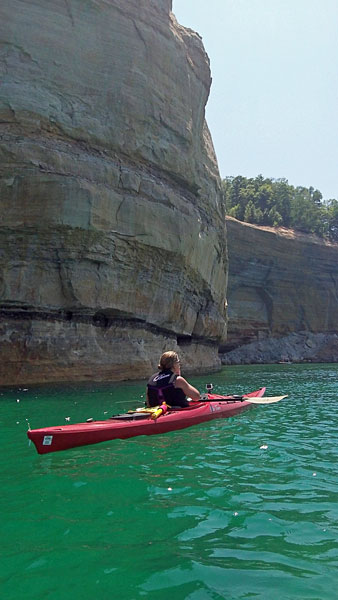
| The marine forecast for the next day was for sunny skies and calm wind. It was not sounding too good for the rest of the week so we decided that this would be our kayaking day. You have to be very careful paddling in Lake Superior especially along the Pictured Rocks cliffs were there may not be a safe place to land for several miles.
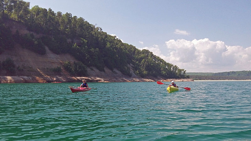
We launched from the east end of Miners Beach and started paddling towards Mosquito Beach. It is about 250 yards from the Lakeshore Trail Parking area to the beach here. I was glad that took our All Terrain Kayak Cart because it would have been a long way to carry all 3 kayaks. The access is better at the Miners Beach parking on the west end of the beach, but by launching where we did our trip was 0.75 miles shorter each way. because it would have been a long way to carry all 3 kayaks. The access is better at the Miners Beach parking on the west end of the beach, but by launching where we did our trip was 0.75 miles shorter each way. |
|
 |
| A cell phone picture that actually turned out good. |
|
 |
| The first thing you come to along the cliffs is Bridalveil Falls. This time of the year it is usually just a dark line on the rocks and a small trickle of water. |
|
 |
| After a little paddling it was time for a candy break. |
|
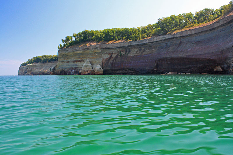 |
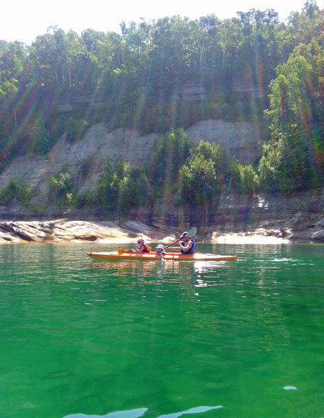
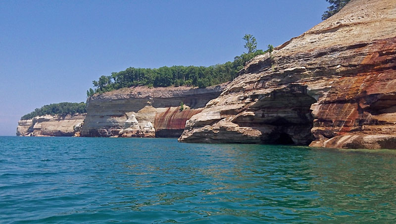
| Just past Bridalveil Falls were some of the most colorful Pictured Rocks cliffs. |
|
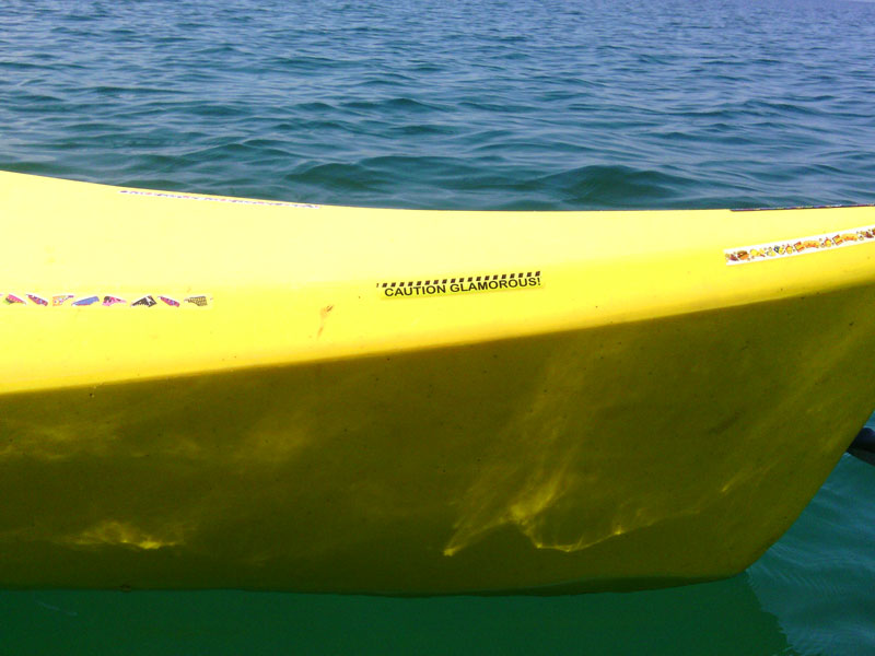 |
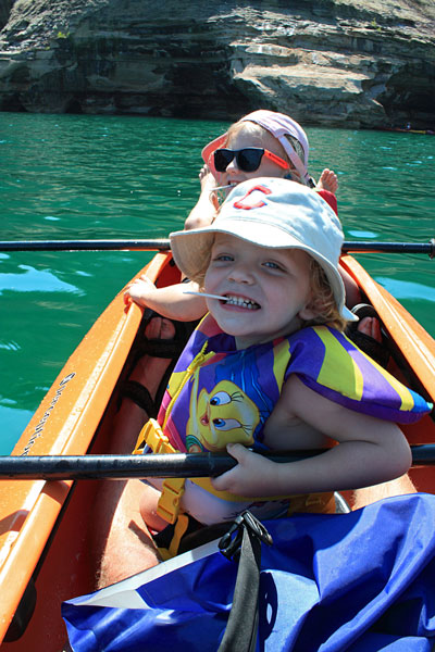
| Regan decided she needed to personalize her kayak before the trip...so take caution. The sparkle hat and sunglasses that she chose went well with this sticker. |
|
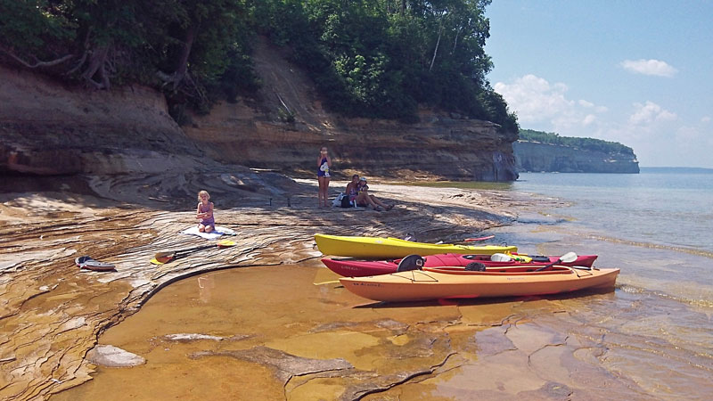 |
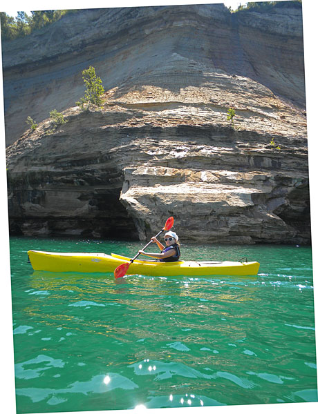
| After paddling for about 2 miles we stopped on a flat spot just before Mosquito Beach for lunch. We found a nice shady stop to sit and about as soon as we started eating the mosquito's and flies started eating us ounce again. We were lucky that they only bothered us on shore and when out in the kayaks it was not a problem. |
|
 |
| Looking out towards Lovers Leap Arch from our lunch spot. |
|
|
| There was a shallow rock ledge extending out under the water here. After quickly downing our sandwiches down we went out swimming to escape the bugs. Even when paddling on a calm day you still have to watch out for the wakes from the tour boats. |
|
 |
| Heading back. |
|
 |
| Looking back along where we paddled. |
|
|
| A GoPro time-lapse of our entire kayak trip from Miners Beach to Mosquito Beach.
The photos really do not do justice to the experience of paddling along the base of the Pictured Rocks cliffs. We were blessed with almost perfect weather and other than getting eaten by the bugs while hauling the kayaks and eating lunch it was a perfect way to spend the day. |
|
|
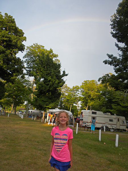 |
| The next day was very warm and humid. Just after breakfast a heavy rain shower formed right over the campground and sent us back inside the camper for a couple hours of reading and watching movies. When this finally passed the sun came out and it was really warm so we spent the afternoon swatting flies at the beach. In the evening another storm passed nearby and gave us a rainbow. |
|
 |
| When it looked like all the rain was past we walked into town and went to Superior Shores Market few a few groceries and ice cream. The night was still unusually warm for up here so we went back down to the beach for another swim. |
|
 |
More clouds and rain came in just as the sun was setting.
|
|
| Fat Biking 12 Mile Beach: |
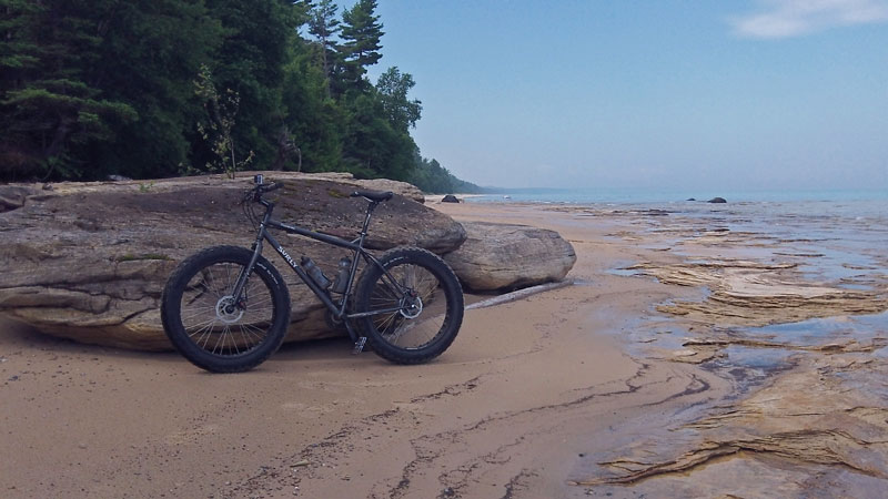 |
| I had planned to hike the Chapel Loop, but with the all bugs and unstable weather I decided it would be best to wait and do this again on another visit. Instead I decided to take the fat bike for a ride on Twelve Mile Beach. I headed southwest down the beach from the Hurricane River Campground into a light breeze off the lake. It was still warm and you could see the humidity hanging in the air over the lake, but the cool breeze and smooth sand made for pleasant ride. Other than a few people at the Twelvemile Beach Campground I had this section of shore all to myself. I even had a bald eagle flush from the trees and fly up the shore ahead of me 3 different times before it headed out over the lake.
At about 7.5 miles I came the little rocky out crop shown in the picture above. I thought it looked like it would be a good place to take a short break before heading back. As soon as I stopped the stable flies attacked. I took off down the shore, but now that I was riding with the wind I couldn't out run them. They liked my ankles and elbows and for some reason my right shoulder next the strap of my camelback must have been bit at least 15 time in almost the exact same spot. The ride back was not as pleasant, but I am still glad that I did it. It took just under 1.5 hours to complete the 15 mile trip. |
|
|
| A 60 second GoPro time-lapse of the Twelvemile Beach fat bike ride. |
|
 |
| The forecast for the afternoon was again hot and humid with pop-up thunderstorms likely. We decided to drive to Munising and then do a few short waterfalls hikes.
Our first stop was The Falling Rock Cafe and Bookstore. This is nice store with a little of everything including: books, coffee, breakfast, lunch, ice cream and free wireless internet. It would be good place to relax and browse some books...if you do not have a 2 year old with you. We looked around a little, ate some ice cream and then it was time to move on.
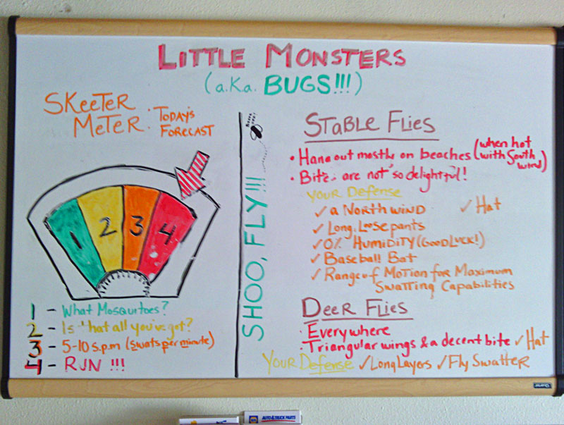
After that we made a stop at the Pictured Rocks Visitor Center. The board at the entrance (shown above) confirmed what we had already experienced.
|
|
 |
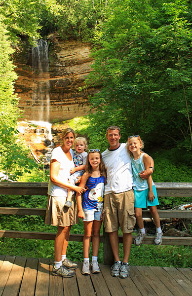
| Our next stop was Wagner Falls just south of Munising. As you can see Reid was really excited to see the falls. |
|
 |
| Wagner Falls is around a 20 foot cascade and is accessed by a short trail and boardwalk. The DNR page says that it is a half mile trail, but it seemed shorter than this. The falls are located 2 miles south of Munising on M94 just past the junction with M28. There is small parking lot and sign on the left side of the road.
Directions to Wagner Falls >> |
|
 |
| From Wagner Falls it was on to Munising Falls. This is another short walk on a paved path and is an easy stop if you are in this area. While we were here we started to hear the familiar sound of thunder and could see a storm approaching from the south. We decided to skip our stop at Miners Castle and headed back to Grand Marais. By the time we got back the storm passed to the west and it was sunny and warm again.
Directions to Munising Falls >>
|
|
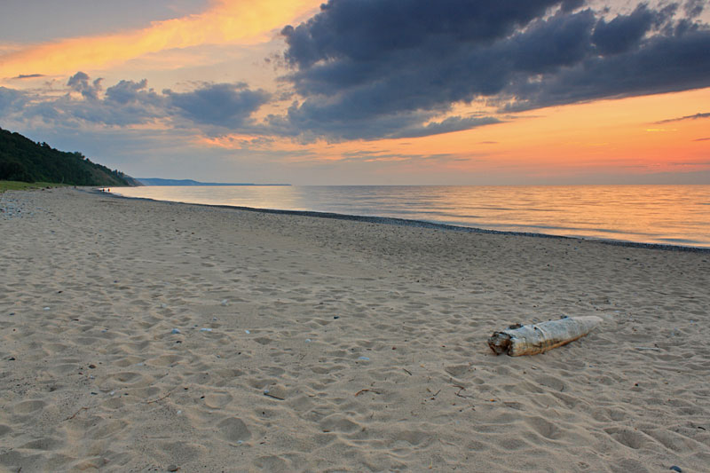 |
| The last sunset at one of our favorite places to watch the sun go down in Michigan.
In the morning it was time to drive back over the bridge to Wilderness State Park. Click the link below for page 3. |
|
|
<< Back to Page 1 Tahq Falls | Home Page | Page 3 - Wilderness State Park >>
Like our Facebook page to get notified when we make new additions to MyMichiganTrips.com >>
|
|
|
|
|
|
|
| |