For this years winter camping we decided to try the White River Trail at Pines Point Recreation Area. We took a short hike to check out the area in the fall and thought it looked interesting enough to come back and explore more. In the winter there is not much activity here. However, during the summer months there is a rustic campground with about 30 sites on the banks of the White River. There is also a day use picnic area with a canoe launch and the famous tuber loop. For more on the tubing see the entry from our day trip up here.
The week prior to this trip it looked like we may have to cancel due to lack of snow. We were fortunate to get about 6 inches just before heading up on Saturday morning. Unfortunately, everyone decided to bail on us at the last minute and it ended up being just the two of us. Most people are just not very excited about winter camping, but with the right gear it is not bad at all.
|
|
 |
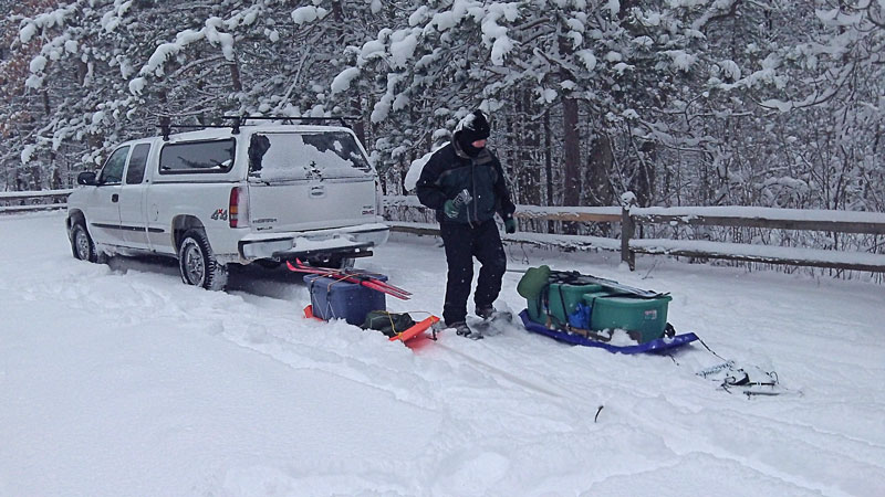
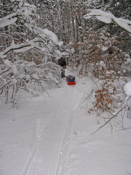
| Getting ready to hitch up to the sleds and hit the trail. From our scouting trip we knew that there was a fair amount of climbing to get up on the ridge above the river. Because of this, we decided to snowshoe in and take along our skies for exploring the area in the afternoon from our camp. Photo by J.V. |
|
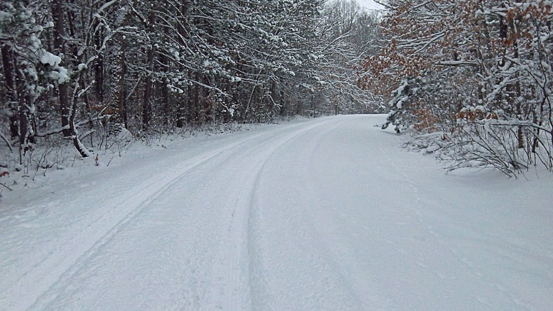 |
| The road back to the parking area was not plowed. It looked like the snow plows turned around about 1 mile back at 168th Ave. We didn't have any problem with 4 wheel drive, but on years with normal snow fall it would likely be impassable. |
|
 |
| We could not find much information or maps about the White River Trail. I first saw it briefly mentioned in my Michigan's Best Campgrounds Book. There is hiker sign near the pit toilet in the day-use area, but no other information. On our previous visit we followed the trail from the sign along the White
River. There were some blue marks on the trees, but then it went through a big section of blown down red pines where it would have been impossible to pull our sleds through. On way back out we found that we could bypass this section by taking an old logging trail that came out to the road by the campground sign shown above. |
|
View Larger Map |
This old road can still be seen on the Google map above. Just a little way in you will come to a 'T' in the trail. Stay to the right and in about a 1/2 mile you will climb to the top of a ridge. Here you will see the single track of the White River Trail running along the edge of the ridge to the left. The first section of the trail parallels fairly close to an old seasonal road that is also on the map above.
|
|
View Larger Map |
| Looking at the satellite map images there is also another option to access the trail. About 0.75 miles up the road from where we parked there is another small parking area. From here it is about 0.75 miles on the old seasonal road mentioned above to where we picked up the trail. |
|
 |
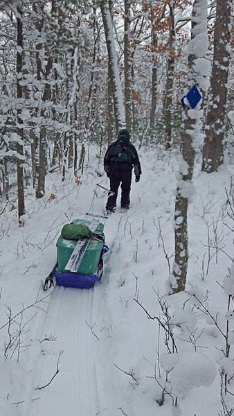
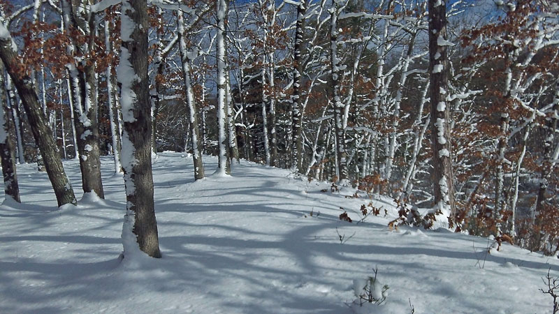
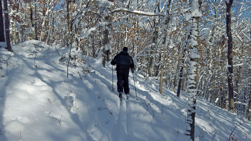
| Heading into the woods. As you can see the trees are starting to reclaim this old logging trail. The fresh snow on the ground and hanging on all the trees made some nice winter scenery. Photo by J.V. |
|
 |
| The White River Trail is well marked with nice new blue diamonds. |
|
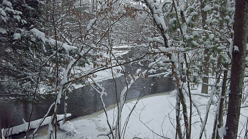 |
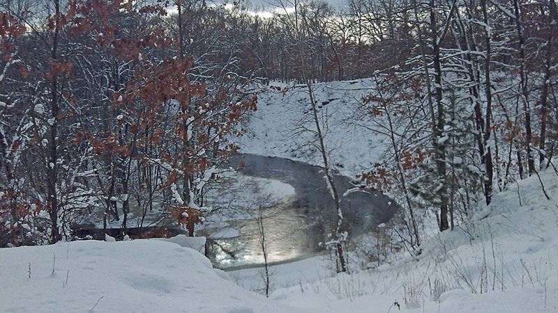
| You can only occasionally view the river from the trail high up on the ridge.
|
|
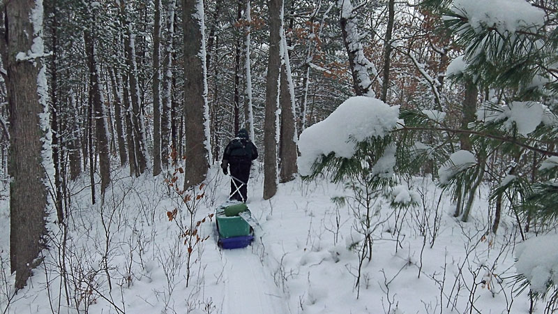 |
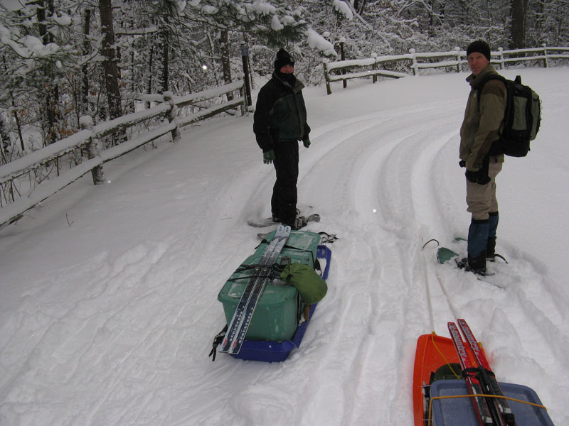
| We snowshoed in about 2 miles pulling the sleds . There were several nice campsite options right on the edge of the ridge over looking the White River Valley, but we thought they would be too exposed to the wind. We decided to cut over the old seasonal road and look for a lower, more protected spot. |
|
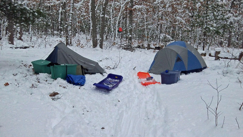 |
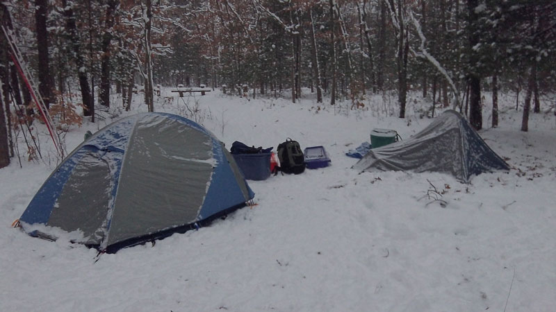
| After circling back a little ways we found a nice flat spot that looked like an old deer camp. We were happy to have the old log fence that you see in the background to use as a seat up off from the snow. After getting the tents setup we were more than ready for lunch. A couple frozen peanut butter and jelly sandwiches really hit the spot. |
|
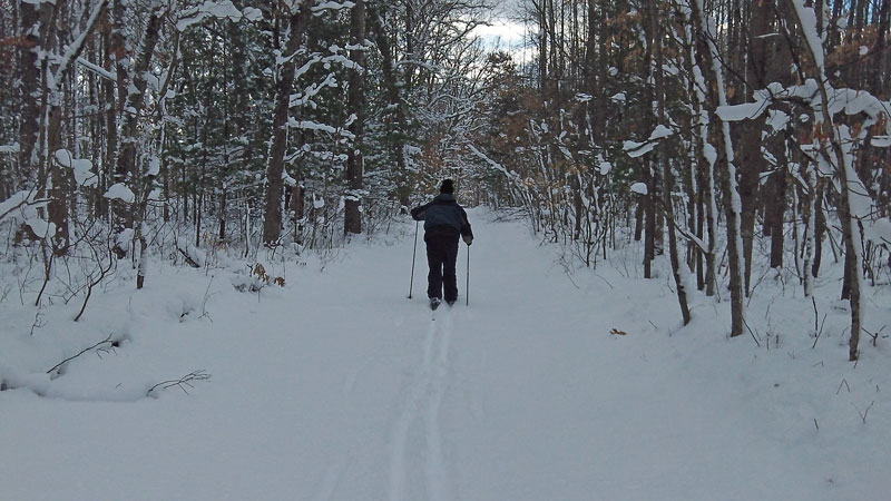 |
| In the afternoon we strapped on the skies and headed further down the road. |
|
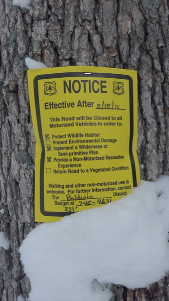 |
We thought that there would be some snowmobile traffic on the seasonal roads. We were surprised to find that we had this whole place all to ourselves! Further down the road we came to these signs on the trees and some pretty major barricades blocking access to the area. It looks like it was just this past spring that the DNR closed the roads and designated it as a non-motorized recreation area.
|
|
 |
| Looking back along our fresh ski tracks. |
|
 |
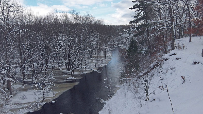
| About 1.5 miles from our campsite we came to a nice overlook on a bend in the White River. |
|
 |
| While we were taking in the view of the river the sun even made an appearance to warm us up. |
|
 |
Looking downstream from around the bend. We continued a little further down the trail from here, but we soon came to private property signs and had to turn around.
|
|
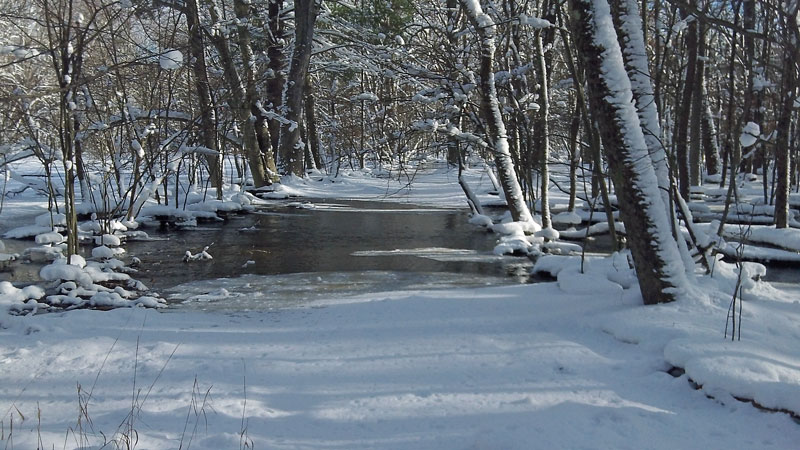 |
| On the way back we found a trail that headed down into the White River Valley. It dead ended into a wetland area where the river was still out of site. |
|
 |
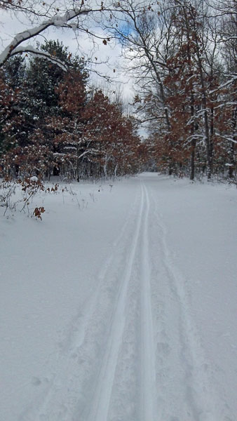
| From here we decided to try and ski this section of the White River Trail back to camp. It was good for a little ways, but then we came to a couple sections that were either new or rerouted and there was too much under brush sticking up through the snow. After scraping our skis through this for a little while we decided to cut through woods and find the road back.
|
|
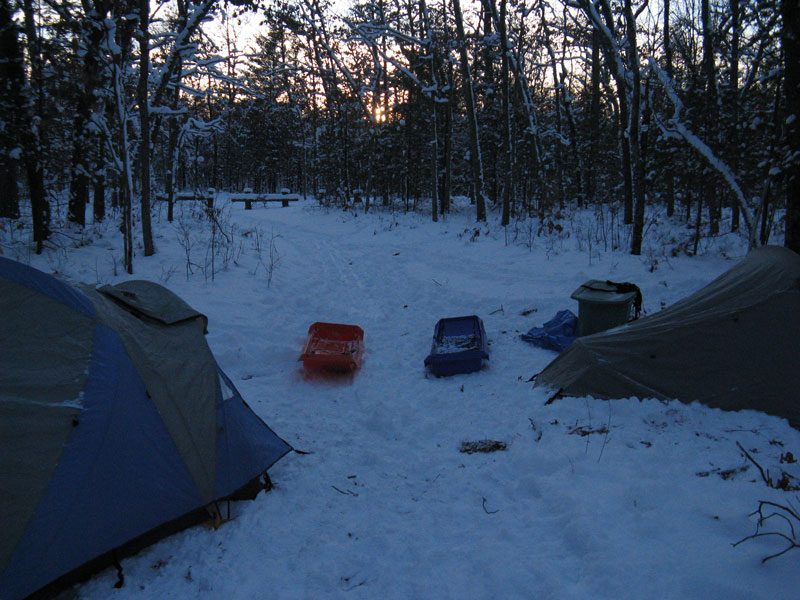 |
| Later when we were back at camp eating dinner a group of 3 snowmobiles rode past. Other than that it was a quiet night. They ended up being the only other people we saw. The skies stayed clear and as soon as the sun went down we could really feel the temperature starting to drop. It wasn't long before the sleeping bag started sounding really good. We put on the headlamps and went for a little walk to warm up and then called it an early night. -Photo by J.V. |
|
 |
By morning it was cloudy and light snow was falling. Looking back at the temperature records we were surprised to see that just after midnight it got all the way down to 2 degrees. I still slept good in my 20 degree mummy bag with my other 30 degree sleeping bag spread over top. I was also glad to have a couple Hand Warmer Packs to put down by my feet.
It was still pretty cold in the morning and by the time we ate breakfast and packed up camp we ready to starting pulling the sleds to warm back up. We decided to take the road back to where the logging trail descends the ridge since we had not traveled this section before. |
|
 |
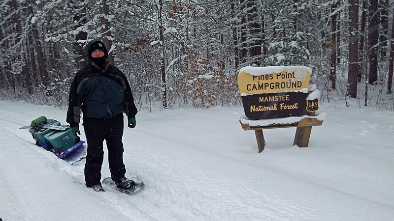
| We explored another part of the old logging trail on the way back. It was a little tight in spots, but ended up coming out along the river in the day use picnic area just down from where the truck was parked. We dragged the sleds up into the parking area and all too soon another trip was over.
Directions to Pines Point Campground >>
MyMichiganTrips Homepage >>
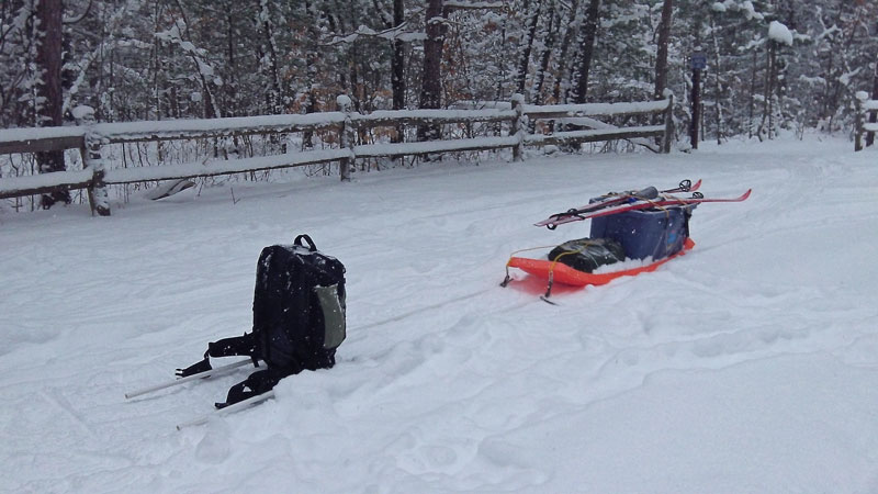
The winter camping pull sled: I switched to a big Rubbermaid Storage Tote instead of using dry bags for this trip. This seemed to be a much better way to go. The tote fit in my sled almost perfectly and I used a couple bungee straps to hold it in and keep the cover on. The bungee also worked good for holding my skies on top. To pull the sled I ran a rope through a couple PVC pipes with holes drilled into the sides a few feet from the ends. Where the rope came out in between the pipes I pulled it over the hip belt of my pack and let it pull against the internal frame. I left the extra pipe sticking out along my sides so I could use my hands help guide the sled and hold it back when going down hills. Overall I was pretty happy with how this setup worked. The only time it was a little hard to control was on a downhill with a turn. instead of using dry bags for this trip. This seemed to be a much better way to go. The tote fit in my sled almost perfectly and I used a couple bungee straps to hold it in and keep the cover on. The bungee also worked good for holding my skies on top. To pull the sled I ran a rope through a couple PVC pipes with holes drilled into the sides a few feet from the ends. Where the rope came out in between the pipes I pulled it over the hip belt of my pack and let it pull against the internal frame. I left the extra pipe sticking out along my sides so I could use my hands help guide the sled and hold it back when going down hills. Overall I was pretty happy with how this setup worked. The only time it was a little hard to control was on a downhill with a turn.
For another design that worked really nice, check out JV's braking bars in the some of the photos above. They go under to sled as it starts to catch up with you and slow it down.
To learn more about doing trips like this see our Winter Camping List and Tips Page >>
|
|
|
|
| |