Ludington State Park is one of the most popular parks in lower Michigan. (Check out our About Ludington Page and you will see why) Most do not think of Ludington as day trip option, but it is only about a 1.5 hour drive from much of West Michigan. A little extra time in the car and money for gas is worth it for everything that Ludington State Park has to offer.
On this Saturday in early fall we paddled the unique Canoe Trail. This canoe
or kayak route is about 4 miles long and follows the shore of beautiful Hamlin Lake and then heads through a couple inland marshes after short portages. The mix of open water and tight passages through the reeds and tree stumps makes for an interesting paddle. We had perfect weather with bright sunshine and almost no wind. Also, by this time of the season there were not any bugs. I would think that the back parts of the Canoe Trail could get buggy earlier in the summer and would recommend taking bug spray just in case.
The start of the Canoe Trail is the beach at the Hamlin Lake day use area. If you put-in next to the boat launch it is just a short carry to the edge of the water.
|
|
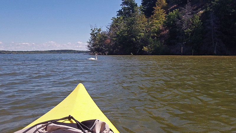 |
| To start the Canoe Trail head straight out across the Big Sable River from beach. Ounce out into the open waters of Hamlin Lake head South (right) along the shore. |
|
 |
| Paddling out along the shore of Hamlin Lake. |
|
 |
| We paddled our kayaks into the first bay looking for the start of the trail, but it is a dead end. |
|
 |
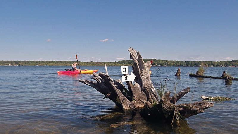
The start of the inland portion of the Canoe Trail is in the back of the second bay that you come to. Paddle through the reeds in the back of the cove to get to the first portage.
|
|
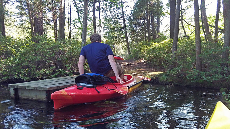 |
There are 4 short portages in the first inland section of the Canoe Trail. All have small docks to help you get in and out of your kayak or canoe. |
|
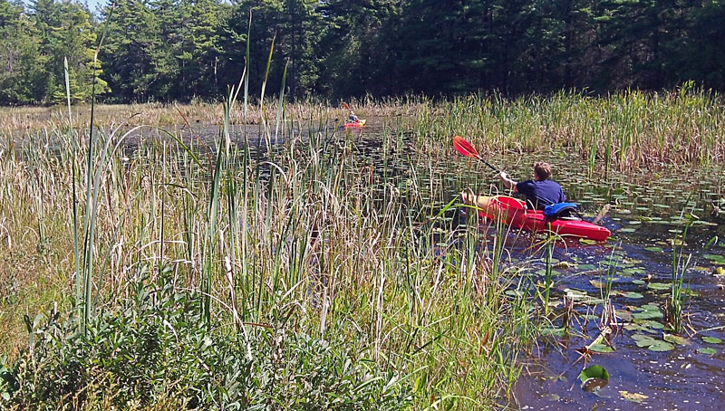 |
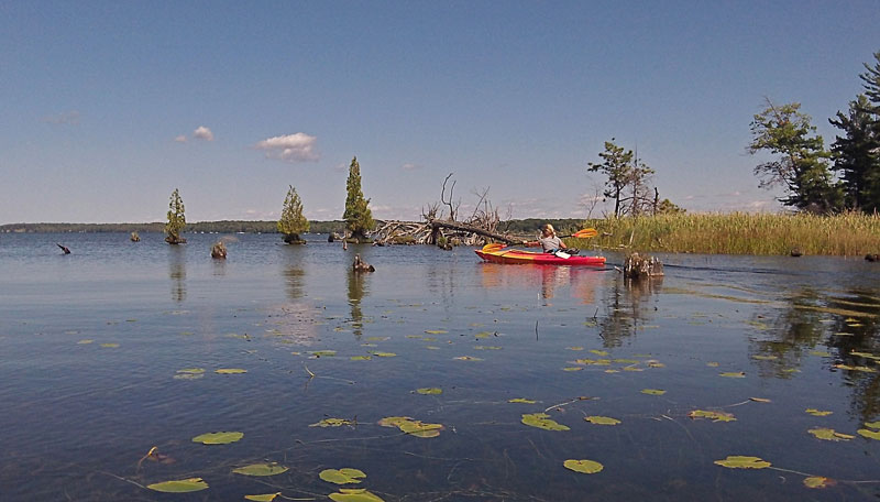
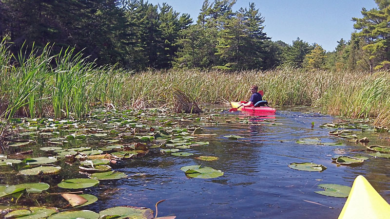
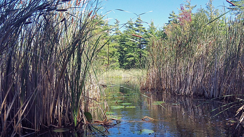
| The back section is an interesting paddle through reed lined ponds filled with lily pads. |
|
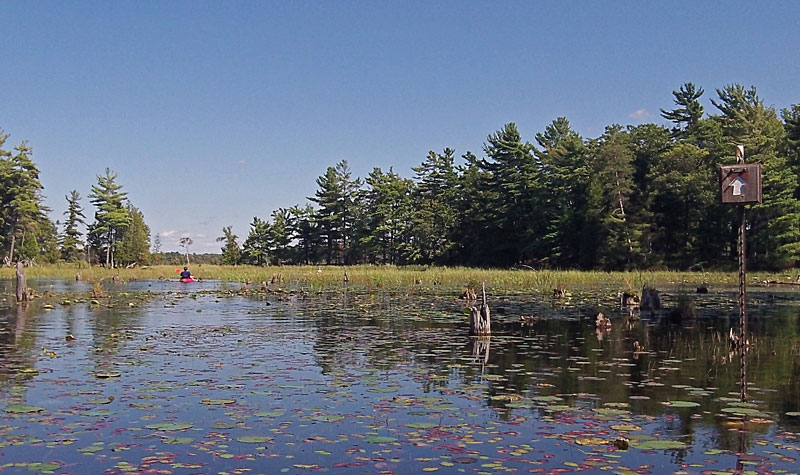 |
Arrows on posts keep you headed in the right direction.
|
|
 |
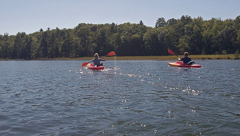
| Heading back out into Hamlin Lake after the first inland section of the Canoe Trail. |
|
 |
| We had to portage over a small sand bar to get back out into Hamlin Lake. From here you continue South along the shore to get to the next inland portion of the trail. If you want to shorten the trip this is also a good place to turn left and head back to the launch. |
|
 |
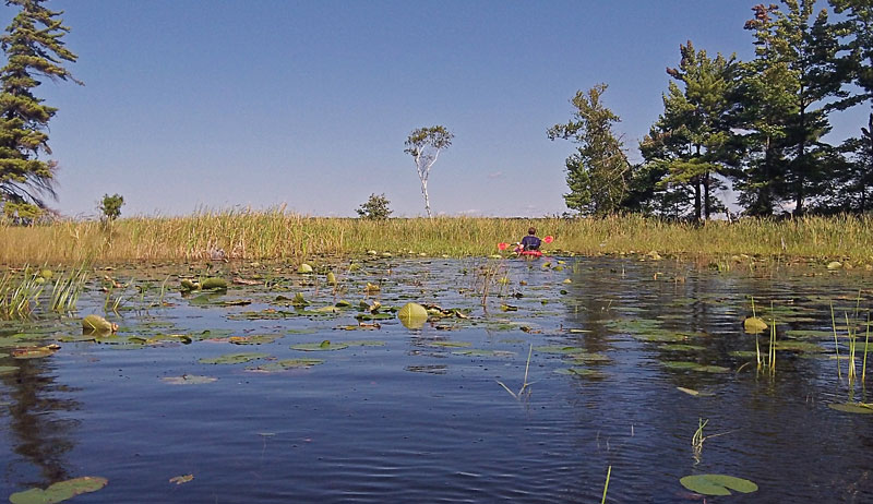
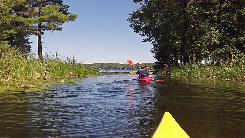
| To access the next section of the Canoe Trail head back through the cattail walls into the next cove. There are no portages in this part of the paddle it is just a nice trip through a narrow marsh out to the Southern boundary of the State Park. |
|
 |
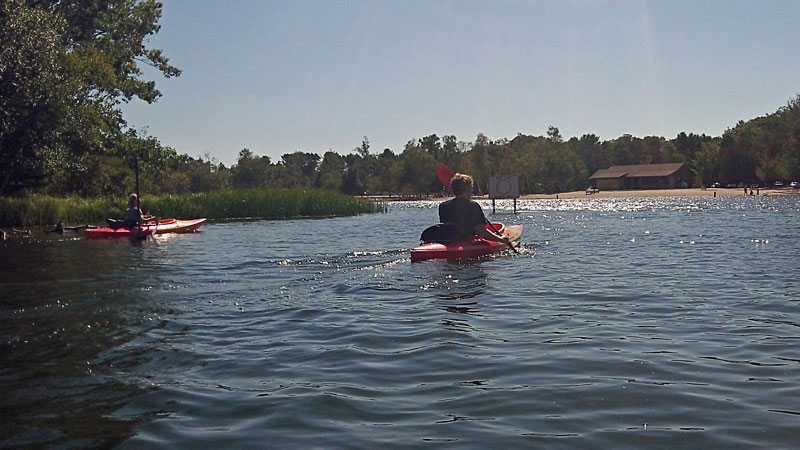
| At the end of the Canoe Trail you will see a couple cottages on shore as you pass the southern park boundary. Across from the cottages is narrow channel the leads back out to the open water of Hamlin Lake . From here we paddled our kayaks back along shore. If the wind is strong from the North you could also turn around and backtrack the way you came. |
|
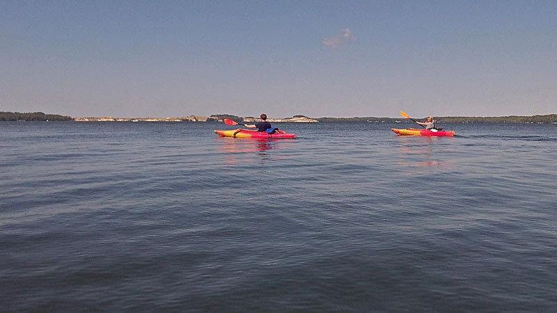 |
A nice calm afternoon on Hamlin Lake.
|
|
 |
Heading back into the beach at the day use area. The trail took us about 1 hour and 45 minutes to complete. I would plan on at least a couple hours for this trip. We paddled at a fairly good pace and didn't take any breaks along the way. The conditions were also perfect without any wind to slow us down in either direction.
If you have not had enough paddling just north of the beach area is the entrance to Lost Lake. Look for the small wooden bridge and paddle under it to enter this hidden part of the lake. Lost Lake is about a 1/2 mile long and has several small coves and islands to explore.
If you do not have your own boat there is a concession in the pavilion shown in the photo above that rents kayaks and canoes starting at $10 an hour.
|
|
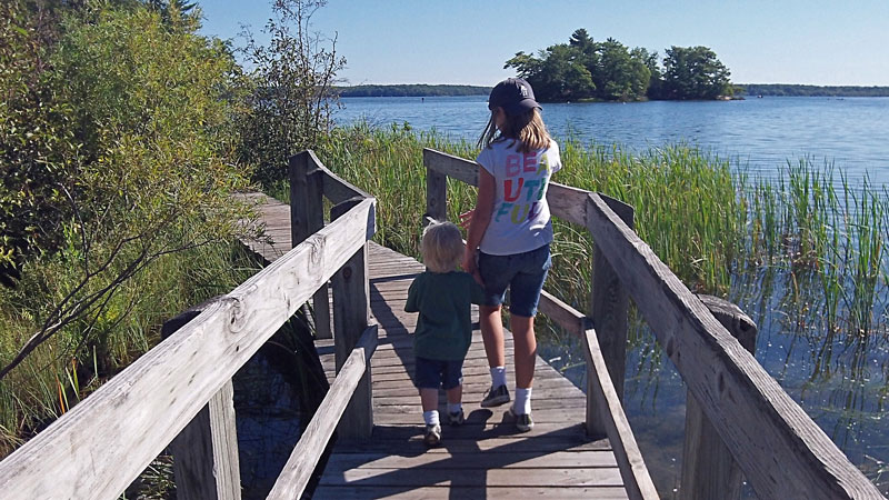 |
If you are looking to stretch your legs after paddling the start of the Island Trail is just North of the take out at the beach. Combining the Island and Lost Lake Trails makes a nice loop that is just under 2 miles around the shore of Lost Lake. To access this hike follow the trail at the North end of the beach about 0.1 miles into the woods along the lake. Then watch for the boardwalk on the right heading out to the islands. The trails are all well marked with maps at each intersection. |
|
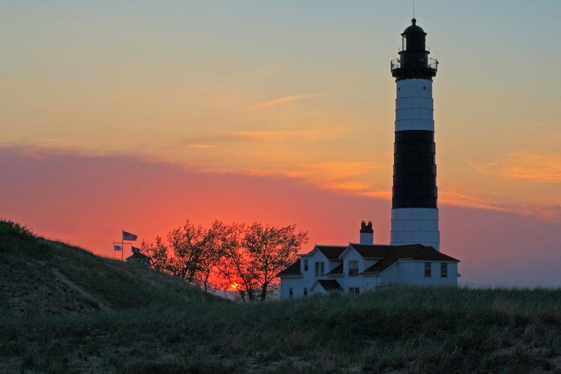 |
Another popular option is the 2 mile walk out to the picturesque Big Sable Point Lighthouse. The lighthouse can be access by either walking the beach North from the Lake Michigan Beach House or by the gravel service road in the Pines Campground. I recommend making a loop by walking out on the beach and back on the service road.
If you are hungry after all this playing the concession in the beach house serves hamburgers, hot dogs and ice cream. Make sure not to miss the sunset over Lake Michigan before heading back home. |
|
<< Homepage | Day Trips | Ludington SP Info Page | Next Ludington Visit >>
|
|
|
|
|
|
| |

