If you are looking for the best loop to day hike in Michigan, try the Chapel Loop in Pictured Rocks National and you will not be disappointed. This 10.4 mile loop passes 2 waterfalls and the middle segment follows the famous Lakeshore Trail along the top of the Pictured Rocks Cliffs for 4.4 miles. This section of the Lakeshore Trail offers a spectacular view almost every step of the way, but you must also watch your step because at times you are only a few feet from the edge of the sandstone cliffs. This hike can also be turned into an easy overnight outing by staying at the backcounty campgrounds located by Chapel Beach or Mosquito Beach. Words really can't explain how awesome this scenery is, so I will stop writing and let the pictures do most of the talking.
|
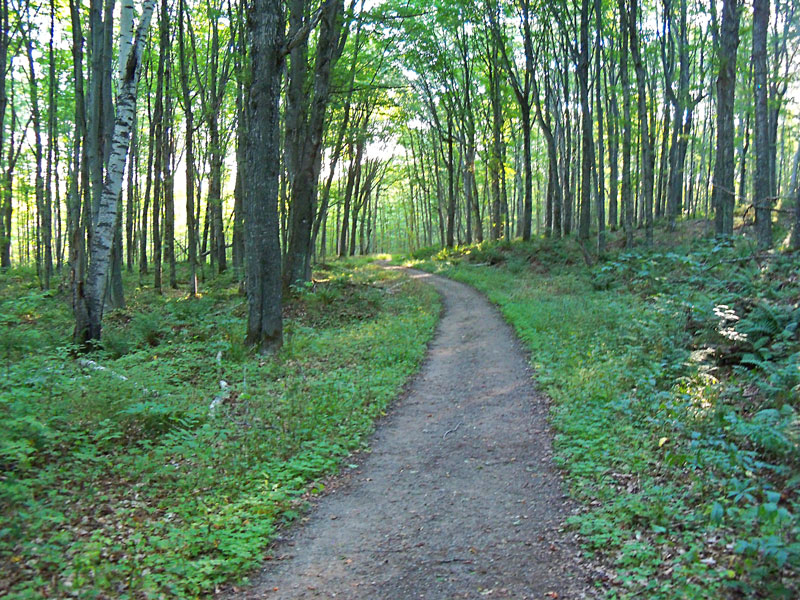 |
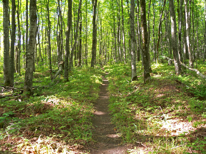
| I hiked the loop in the counterclockwise direction. The first 1.3 miles from the parking area to Chapel Falls is an easy walk on an old road or railroad bed. |
|
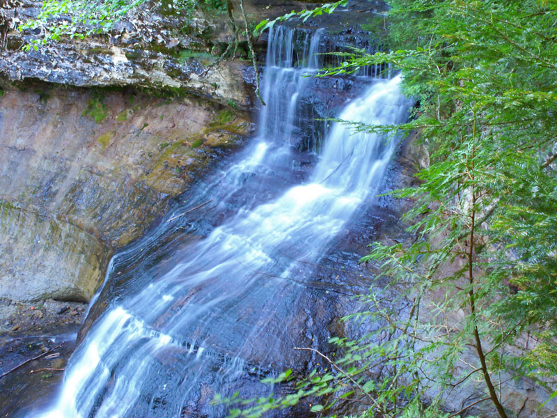 |
| The first view of Chapel Falls is from a platform near the top of the cascade. |
|
 |
| The trail then loops around for another view of the falls trough the trees. Chapel Falls is 60 feet tall, but when I was here the view was partially obstructed by the trees. Early spring or late fall is probably a better time to see this waterfall. |
|
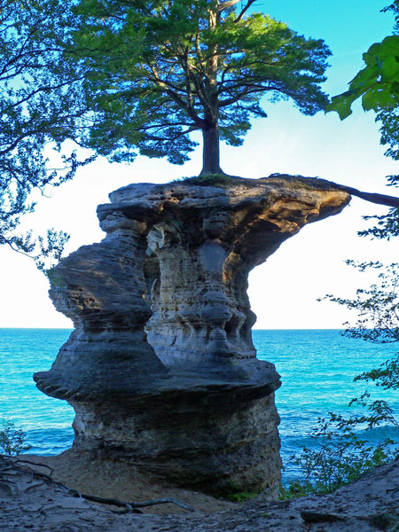 |
| In another 1.8 miles you reach the intersection with the Lakeshore Trail and Chapel Rock. The tree on the top has a big root that goes across the gap to the mainland and this is were it gets most of it's water and nutrients. I read that at one time this root ran on top of an arch that as since collapsed. It is hard to believe this tree survives on top of this rock on the edge of Lake Superior. |
|
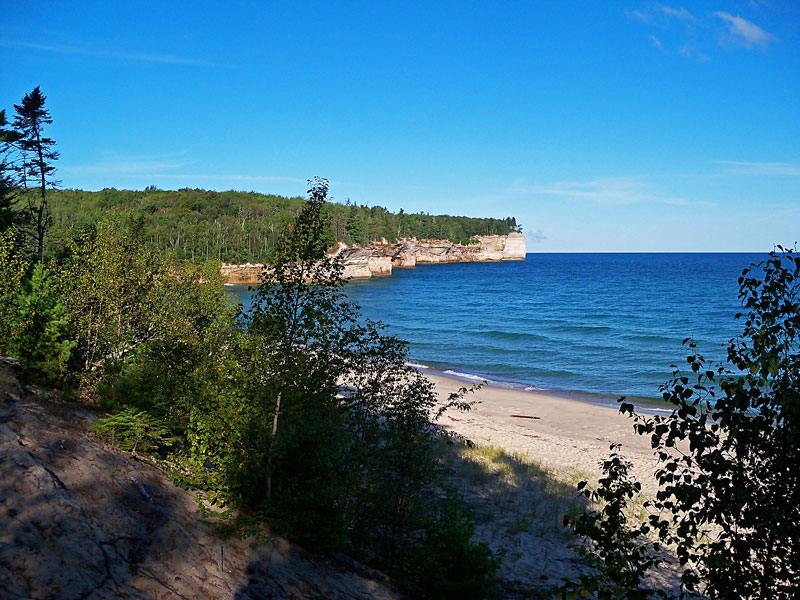 |
| Just past Chapel Rock is the start of Chapel Beach. This is also the location of the first hike-in campground. |
|
 |
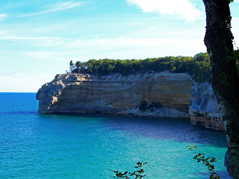
| The cliffs at the west end of Chapel Beach. |
|
 |
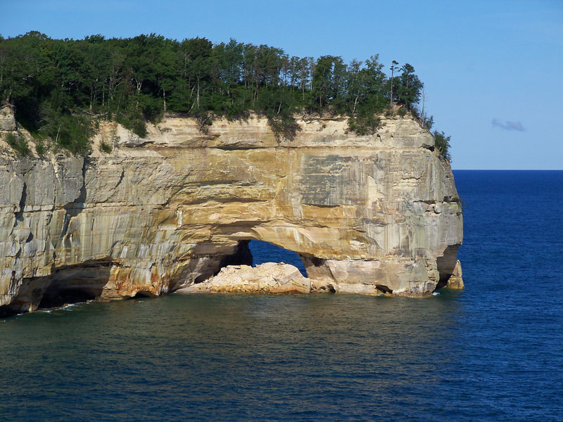
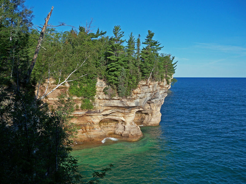
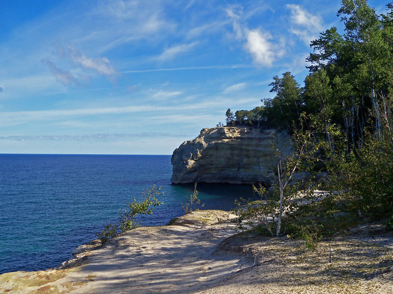
| Approaching Grand Portal Point on the Lakeshore Trail. |
|
 |
| Another angle of Grand Portal Point. |
|
|
 |
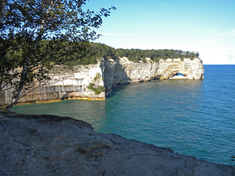
| The beach on the top of Grand Portal was a good place for a short rest. It is 1.5 miles from Chapel Beach and 4.6 miles from the trailhead. |
|
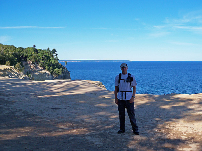 |
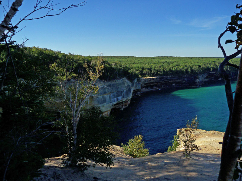
| The view looking west towards Grand Island from the top of Grand Portal Point. |
|
 |
| Indian Head is the next named rock formation that you the come to on the Lakeshore Trial. |
|
 |
| One more shot looking back to Indian Head from a little further down the trail. |
|
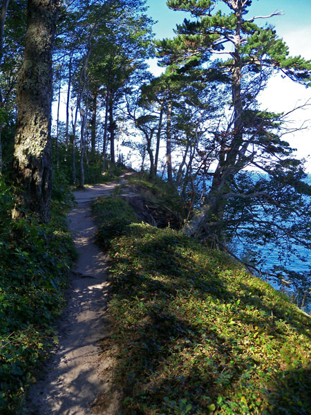 |
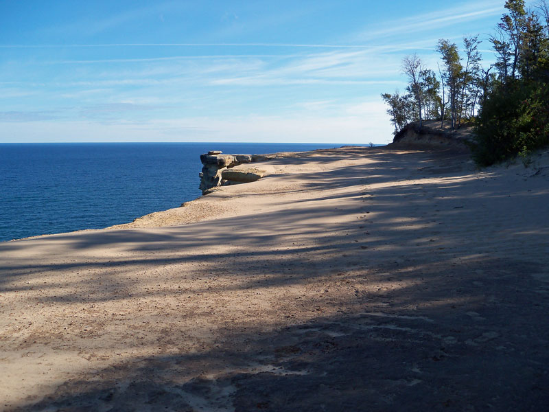
| The Lakeshore Trail is fairly easy walk on a single track that is often only a few feet from the edge of the cliffs. |
|
 |
| Darker stained rocks along the trail. |
|
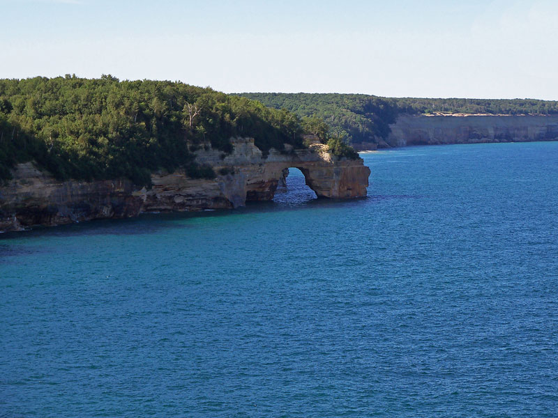 |
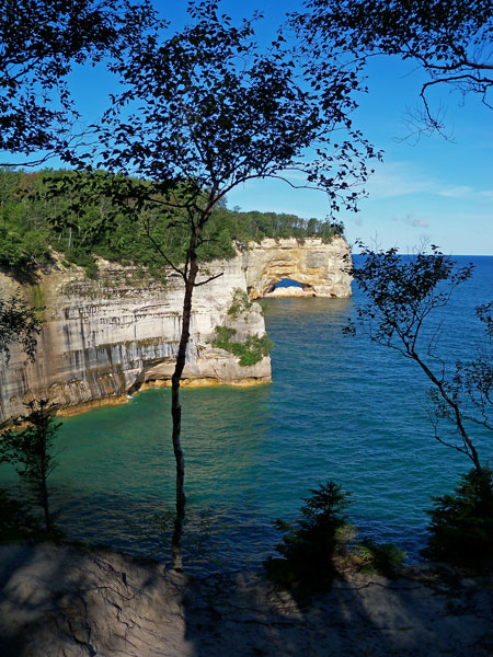
| The sea arch known as Lover's Leap on the way to Mosquito Beach. |
|
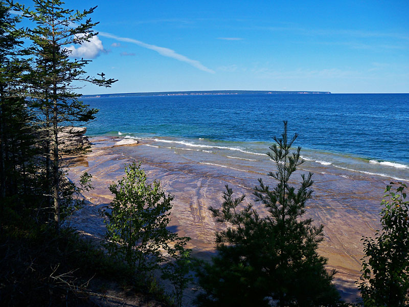 |
| Rock shelves just under the water as you start dropping down towards Mosquito Beach. |
|
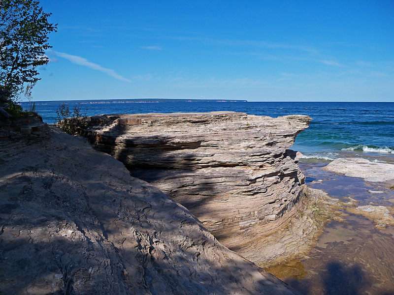 |
| A sea stack by mosquito beach. |
|
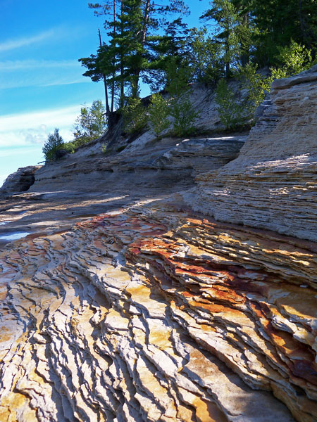 |
| The sand stone layers near Mosquito Beach. |
|
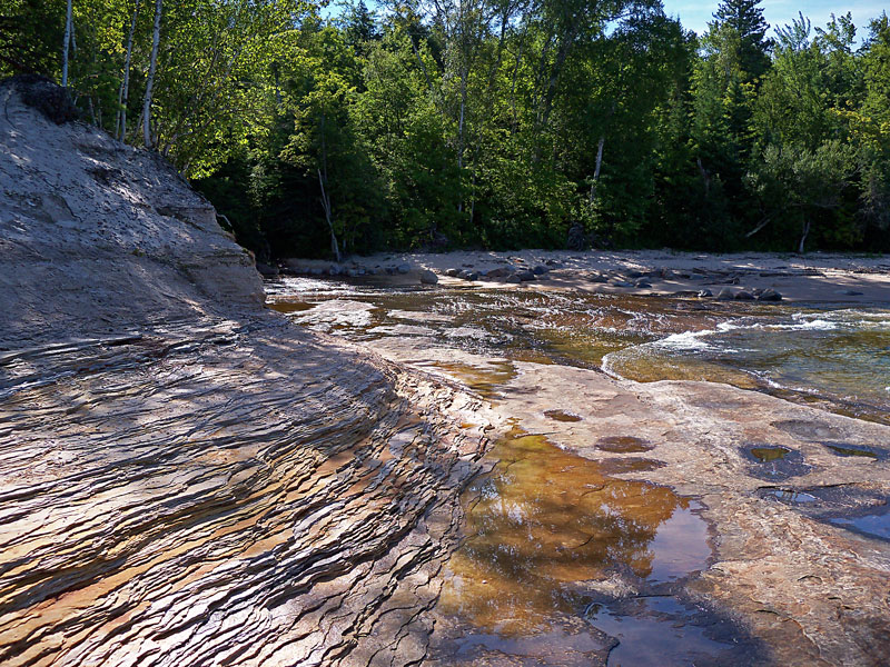 |
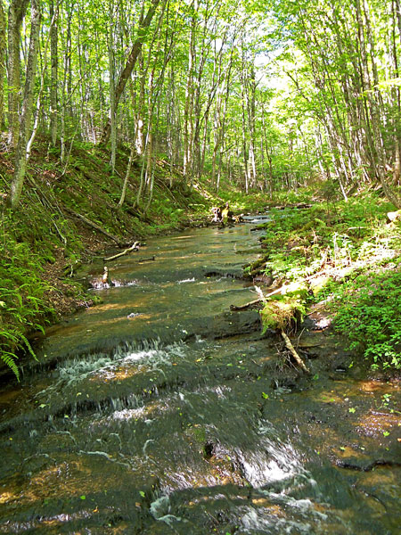
| The Mosquito Creek flowing over the sandstone and out into Lake Superior. The other backcounty campground is located nearby. |
|
 |
| After crossing the Mosquito Creek you turn off the Lakeshore Trail and starting heading inland towards Mosquito Falls. There is another trail just before the creek that will take you back to the parking area in 1.9 miles. By continuing on to the Mosquito Falls trail it is a 2.6 mile walk back to the trailhead. |
|
 |
| Crossing Mosquito Creek just before the falls. |
|
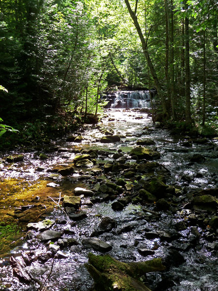 |
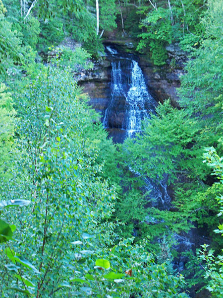
| Looking up stream to the Mosquito Falls.
|
|
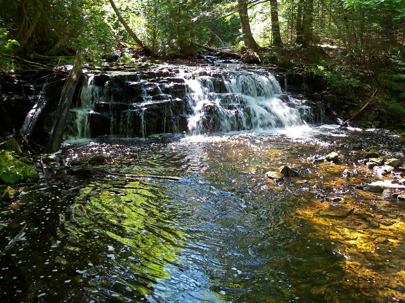 |
| Mosquito Falls is one of the smaller waterfalls in Pictured Rocks National Lakeshore at about 10 feet tall.
It was probably because I was getting tired, but the trail from the Mosquito Falls back to the parking area seemed like some of the toughest of the entire hike. Most of the loop is fairly flat walk without too many rocks or roots until this section. |
|
|
The Chapel Loop trail map.
If the map does not show above click here >>
The 10.4 mile loop took just under 4 hours to complete and is definitely on the top of my favorite hikes list.
When I started at 7:45 am the parking area only had 3 cars left overnight by backpackers. I only saw a couple other people along most of the trail and they were by the back county campgrounds at Miner's Beach and Mosquito Beach. By Mosquito Falls it started to get busy and when I got back to the parking area it was completely full and cars were starting park up the sides of the road. If you plan to do this hike an early start is recommended.
Directions to the Chapel Area trailhead >>
There are also several shorter day hike options in this area. This is from the Pictured Rocks Day Hikes bulliten:
Chapel Basin Area -
Several hikes are available in this
area, depending on what trails you take and how long you
wish to walk. The 3.0 mile trail from the Chapel parking
lot to Chapel Falls runs along an old roadbed. Sixty foot
high Chapel Falls is one of the most beautiful waterfalls
in the park. If you continue on this trail for 1.8 miles (one
way), you will see Chapel Rock. If you begin at the Chapel
parking lot and walk the north/west side of Chapel Lake,
Chapel Beach is a 6.1 mile round trip.
The longer 9 mile Chapel loop begins at the parking lot,
passes Chapel Falls, Chapel Rock, and continues along the
Pictured Rocks cliffs to Mosquito River. The Mosquito Falls
Trail connects with this trail, adding one mile to the hike.
Consult a park map before you hike in this area as there
are several hiking options. |
|
|
<< Back to Our Home Page | Back to our Michigan Hikes Page >>
Like our Facebook page to get notified when we make new additions to MyMichiganTrips.com >>
|
|
|
|
|
|
|
| |